

Beinn Mothal [Ben Mohal]
Good walks are even better shared.
Overview
Beinn Mothal [Ben Mohal]
Welcome to Beinn Mothal, or as it’s affectionately known to locals, Ben Mohal! Towering at 582 meters, this Marilyn in the Scottish Highlands is a gem for hikers looking for an invigorating trek with a side of spectacular views.
Geology
Beinn Mothal is primarily composed of schist and granite, which tell tales that date back over 400 million years. The rustic rock formations provide a stunning backdrop, making you feel as if you’ve stepped back into the age of the dinosaurs—without the risk of being eaten, of course!
Routes
The most popular route starts from the picturesque village of Mallaig. The 8 km trek is moderately challenging, featuring well-defined paths that beckon you through beautiful glens and sprawling heather fields. Don’t forget your camera—the view from the summit is worth every step!
Summit Features
At the peak, you’ll find a small cairn to mark your triumph. It’s a perfect spot for a victory photo and to enjoy your well-deserved sandwich while soaking in the majesty of your surroundings.
Terrain Type
Expect to encounter predominantly grassy terrain interspersed with rocky patches. Keep your eyes peeled for those boggy spots, especially after rain; they can be trickier than a cat on a hot tin roof!
Views
From the summit, the vistas are nothing short of breathtaking. You’ll be rewarded with views of the Knoydart Peninsula, Loch Nevis, and on clear days, the magical isles of Skye and Rum. The best time to enjoy these scenes is during late spring or early autumn, when the skies are clearer and the heather blooms like a painter’s palette.
Hazards
While the path can be inviting, it’s important to keep an eye out for loose stones—after a good rain, they might get a little slippery. And remember, the Scottish weather can turn quicker than a squirrel on caffeine, so be prepared for gusty winds and sudden temperature drops.
Nearby Summits
If you’re feeling adventurous, consider conquering nearby peaks such as Sgurr na Ciche (1040 m) and Ladhar Bheinn (1020 m). Collect them all!
Access
Getting to Beinn Mothal is a breeze, as there’s limited parking available in Mallaig, and public transport services run frequently, especially during peak season. Mallaig has everything you need—cafes, shops, and perhaps the best fish and chips this side of the Atlantic!
Facilities
Whether you need a quick bite or to relieve yourself, Mallaig has it covered. Treat yourself to a cup of tea and some tasty treats before or after your hike.
History
The curious name 'Beinn Mothal' intriguingly translates to 'Hill of the Slaughter' in Gaelic, hinting at a rich tapestry of history and myth that surrounds this scenic location. Feel free to ponder what brave deeds may have occurred here as you stand on its summit.
In conclusion, Beinn Mothal is a must-visit for any hiking enthusiast craving natural beauty and a hint of adventure. So lace up those boots, grab your walking stick, and head out to embrace the wonderful Scottish outdoors!
Explore routes near Beinn Mothal [Ben Mohal]
Public walks starting within 80 km of this hill. Nearby does not mean a route reaches the summit; check its map and access before setting out.
Beautiful private beach walk Isle of Harris
View route
Berneray Community Hall to the beautiful beach
View route
Route planning notes
These notes describe possible approaches, not verified navigable routes or permission to cross land. Check current paths, local access rules and conditions before setting out.
Starting from the village of Mallaig
A relatively straightforward ascent from the village, with clear paths leading through beautiful glens and heather-covered slopes.
Make a day of it, together
Find someone to share the walk with, or organise a day out along a route you like.
Photo Gallery
View all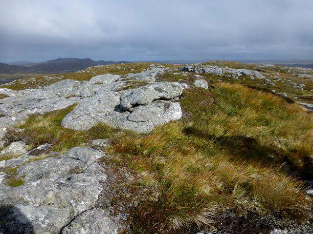 Photo could not load
NB1723 : Ben Mohal [Beinn Mothal] Summit
Rude Health
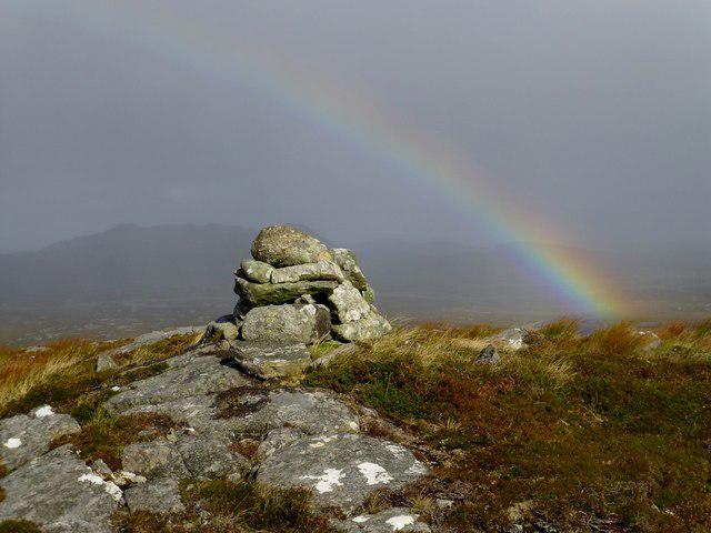 Photo could not load
NB1724 : Ben Mohal [Beinn Mothal] Cairn
Rude Health
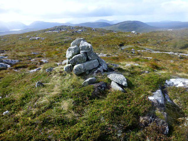 Photo could not load
NB1724 : Ben Mohal [Beinn Mothal]
Rude Health
Hill facts and local notes
Classifications
Elevation
207m
679 ft
Prominence
132m
Coordinates
58.1153, -6.7953
NB177240
OS Map
13 14
Explorer: 458 459W
At the Summit
The summit features a small cairn marking the highest point, offering a perfect spot for photos and a well-deserved snack.
Terrain & Geology
Beinn Mothal primarily consists of schist and granite, offering a glimpse into the region's geological history. The rock formations are over 400 million years old, providing a stunning backdrop for the hiking experience.
Views & Scenery
From the summit, you can enjoy breathtaking views of the nearby Knoydart Peninsula, the vast Loch Nevis, and beyond to the isles of Skye and Rum.
History & Heritage
Name Origin
The name 'Beinn Mothal' is derived from the Gaelic language, translating to 'Hill of the Slaughter,' possibly reflecting a historical or mythical event.
Historical Significance
The area is steeped in history, playing a role in the Gaelic culture, and offers a serene retreat for those seeking a connection with nature.
Getting There & Facilities
Check current local access restrictions, parking rules and transport timetables before travelling. These notes do not confirm public access to the summit.
Parking
There is limited parking available in Mallaig, which provides good access to the trailhead.
Public Transport
Mallaig is accessible via train from Fort William or by bus services that run regularly throughout the summer months.
Nearby Facilities
Mallaig has several cafes, restaurants, and public toilets, as well as shops where you can stock up before heading out.
Safety Information
Known Hazards
- Watch for loose stones, especially after rain. The weather can change rapidly; be prepared for sudden drops in temperature and visibility.
General Safety Tips
- Check weather conditions before setting out
- Carry appropriate clothing and equipment
- Let someone know your planned route
- Take a map, compass, and GPS device
- Carry emergency supplies: food, water, first aid kit, torch
Hills
Some common questions about the hills answered
Are there group walks up Beinn Mothal [Ben Mohal]?
Many walkers use Walkmates to join or organise walks with others. You can check for group walks around Beinn Mothal [Ben Mohal] through the maps
Are there other walkers around Beinn Mothal [Ben Mohal]?
Activity varies by location and time, but Walkmates lets you see whether others have shared walks or shown interest in this area. Find other people through the walking friends search walking friends for Beinn Mothal [Ben Mohal] search or of course create your own walk for Beinn Mothal [Ben Mohal]
Can I organise a walk to Beinn Mothal [Ben Mohal]?
Yes. If there aren’t any walks listed already, you can create a walk and make it available for others to join.
If you're signed up to Walkmates, you can create a walk to Beinn Mothal [Ben Mohal].
How do I find a walk up this hill?
There are often multiple ways to walk this hill, depending on experience and route preference. Walkmates helps you explore walks and routes that others have shared.
Can I suggest a new route up Beinn Mothal [Ben Mohal]?
Yes. You can suggest or create routes to share with others. Walkmates focuses on the social side of walking, so routes are used to help people organise walks and explore areas together, rather than as detailed navigation tools or route libraries.
Other uses really appreciate knowledgeable walkers sharing their routes. Share your favourite route to Beinn Mothal [Ben Mohal] here
The is an error or something incorrect about this hill. How do I let you know?
We always strive to keep the information on Walkmates as accurate as possible. If you find an error, please let us know through the contact form and we'll aim to correct it as quickly as possible
Community Discussion
Comments
Location
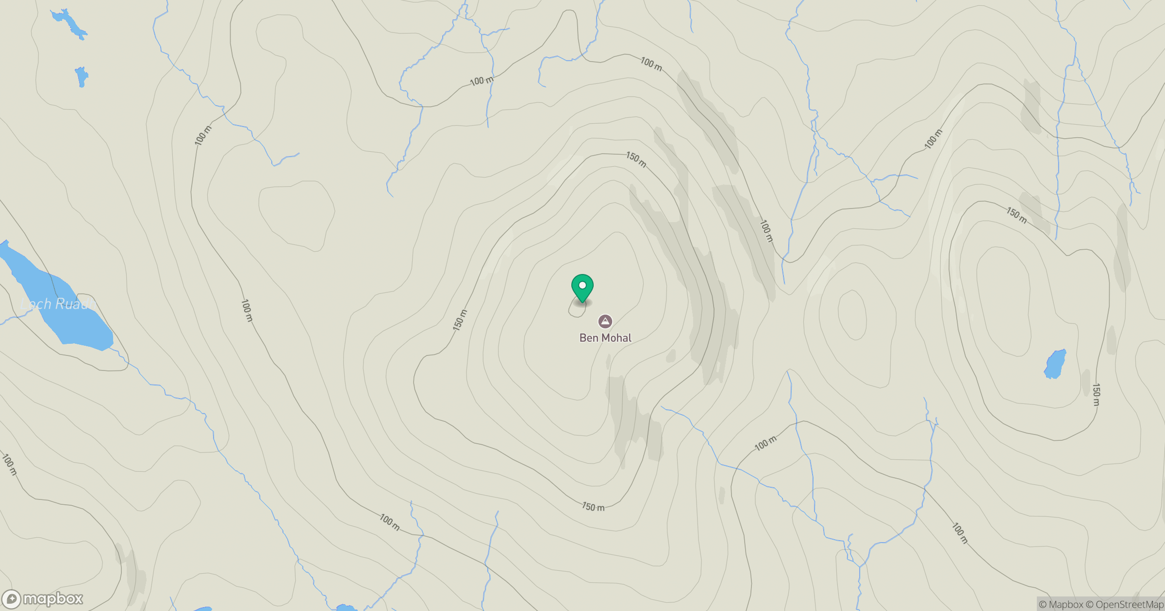
Grid reference: NB177240
View on OpenStreetMapOpens a map in a new tab, centred on the hill.
Hills within 30 km
Straight-line distance, not a walking route or confirmation of access.
An Cliseam [Clisham]
800m
Beinn a' Charnain
215m
Sgalabhal [Scalaval] [Scalabhal]
260m
Cearnabhal [Kearnaval]
378m
Liuthaid
492m
No comments yet. Be the first.